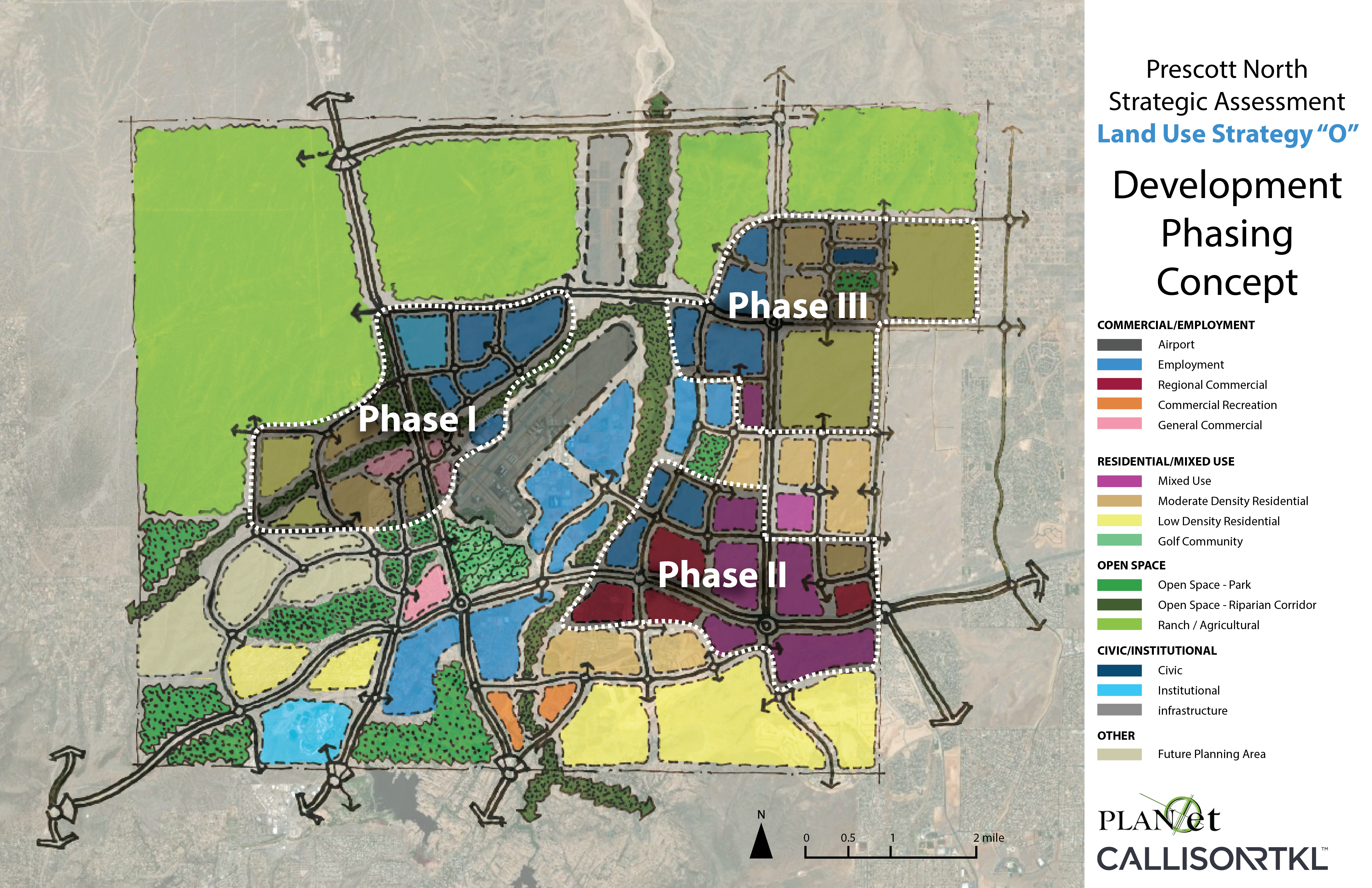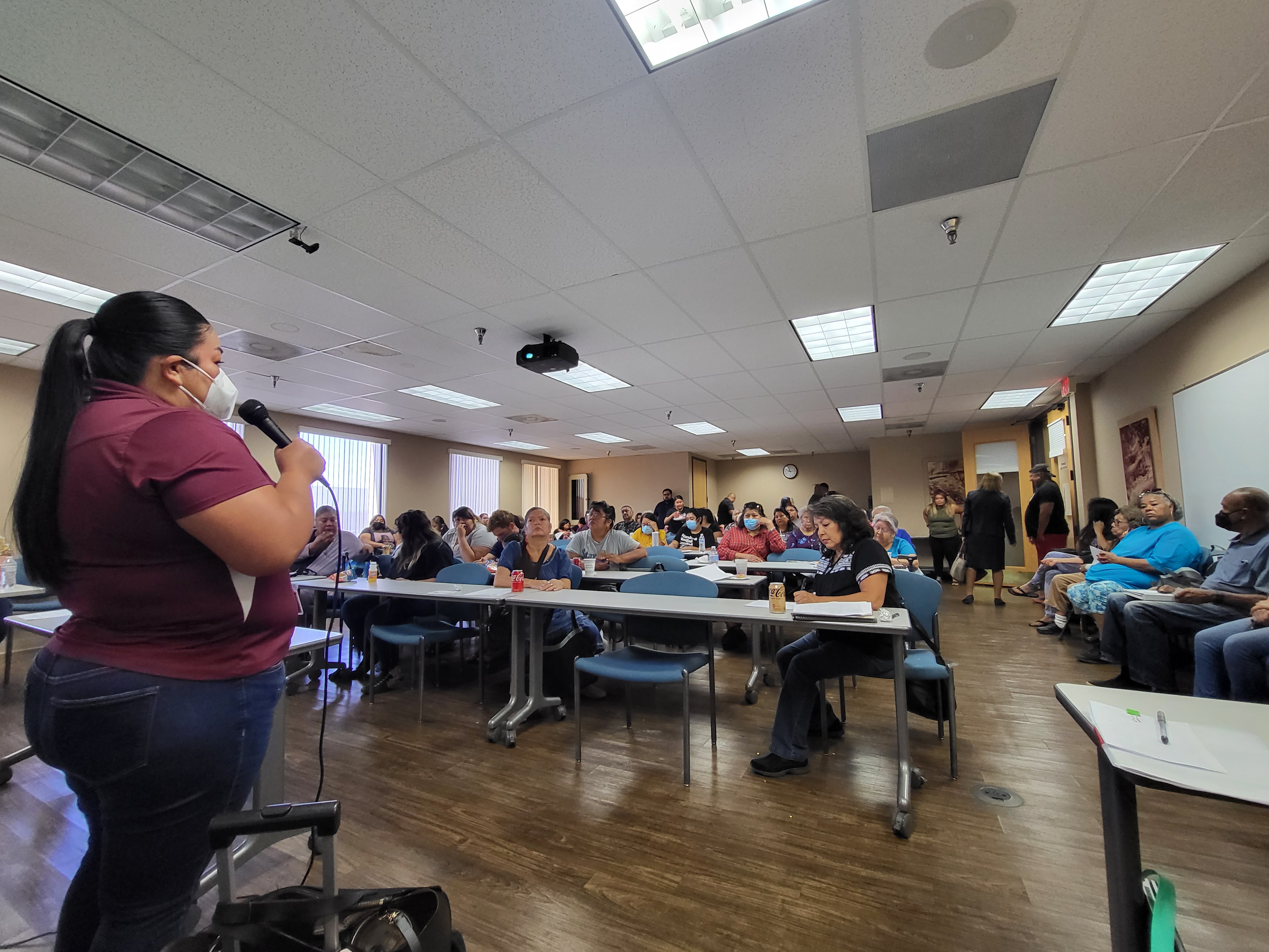
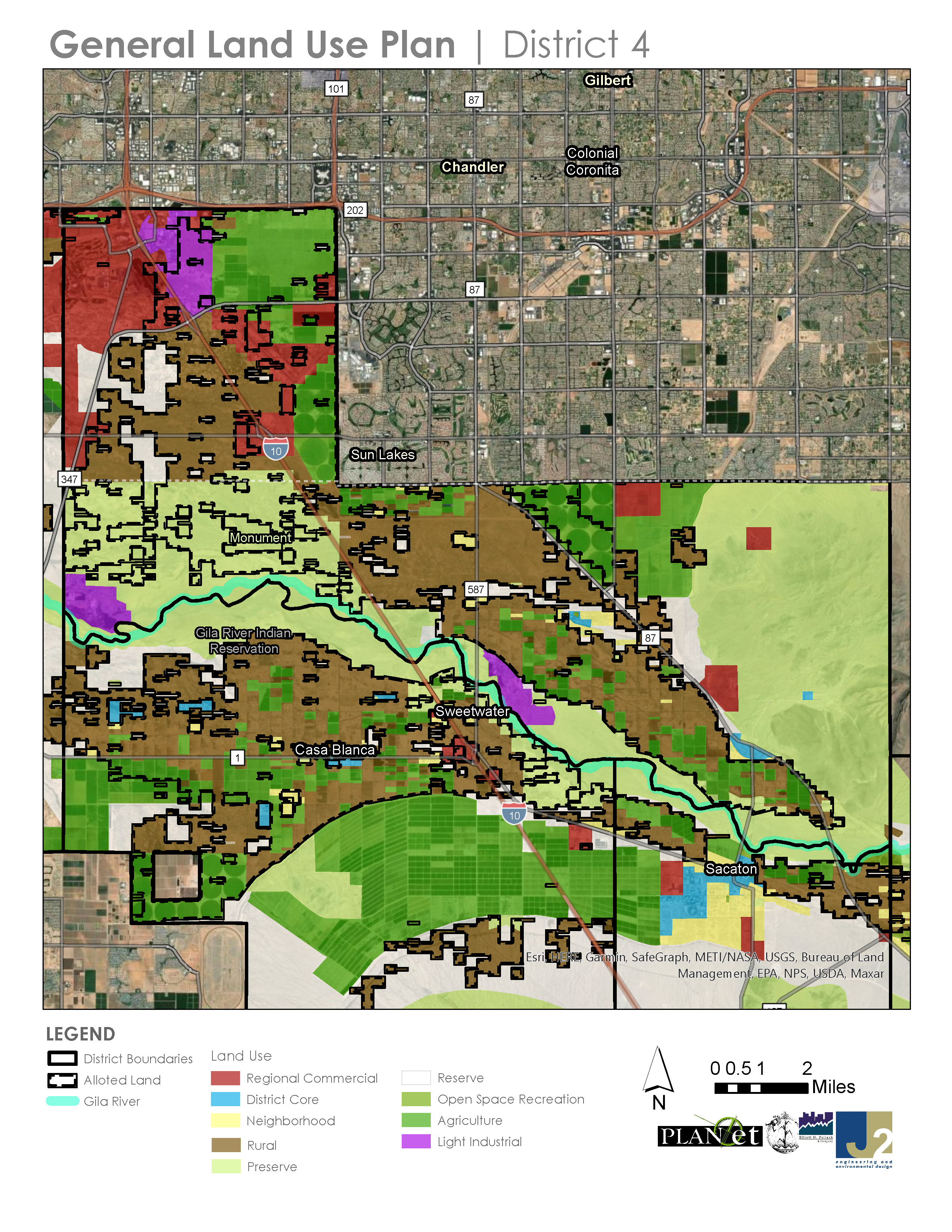
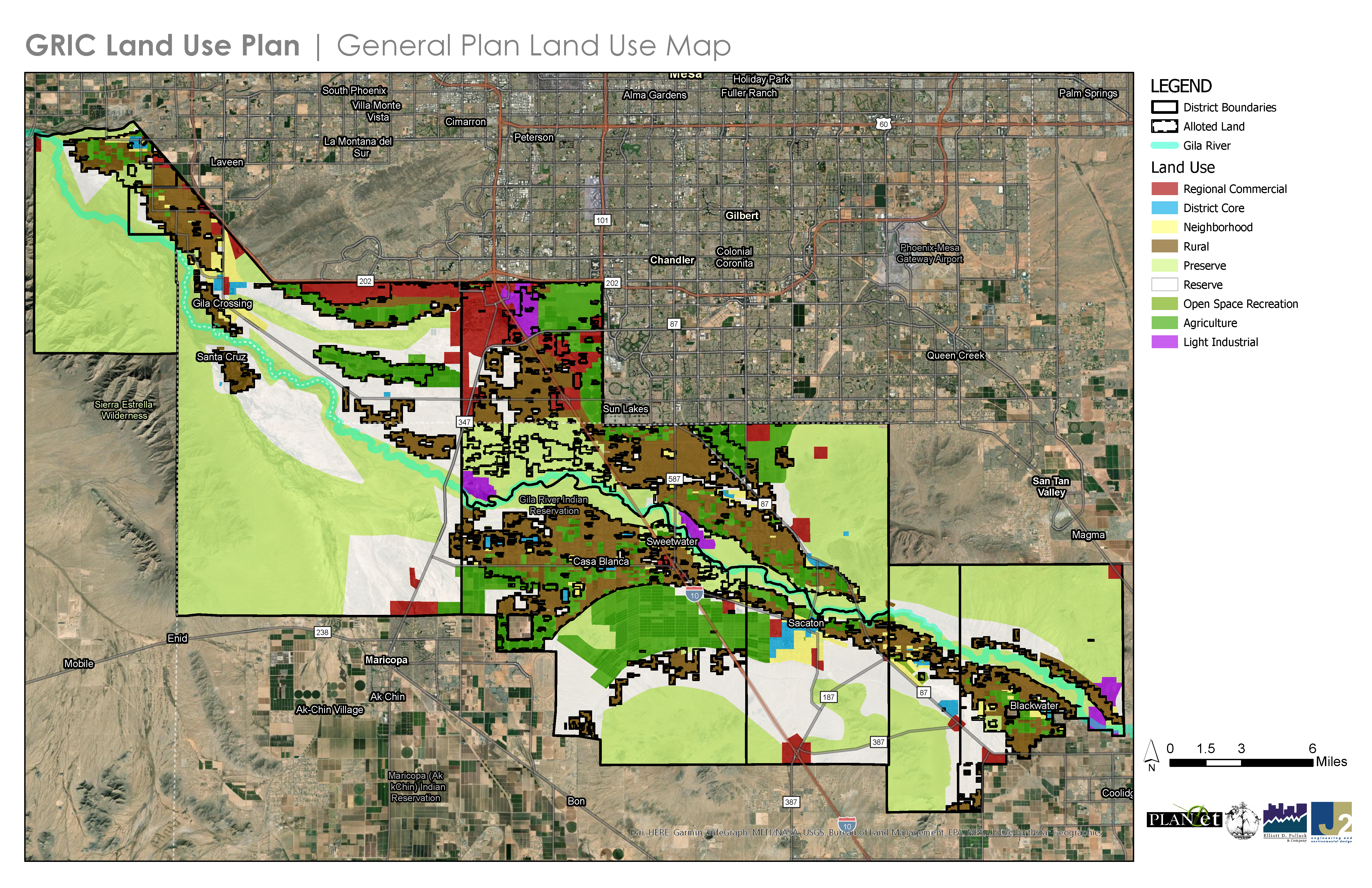
PLANet, in partnership with Bahozhoni Development created a General Land Use Plan, plan policies and strategies, and subconsultant management for this project. The project required development of Community-wide digital current land use and zoning maps, as well as other maps that supported the recommended land uses. District-specific presentations to assist in visioning and to describe the General Land Use Plan process to community members were developed by PLANet with support from Bahozhoni, and on-line and in face-to-face GIS based land use maps and interactive presentations were developed by PLAN*et to help convey land uses recommended in the plan and the plan goals and strategies. The public engagement process includes meetings in each district, with the Youth Committee, two days of focused discussions with Tribal departments and other stakeholders, and planned meetings with Standing Committees and a Tribal Council work-session.